30 June 2025
North Sea Canal Area
Every year, the project office organizes a congress where all stakeholders come together to reflect and look ahead. At the NZKG Annual Congress on November 10, 2023, the
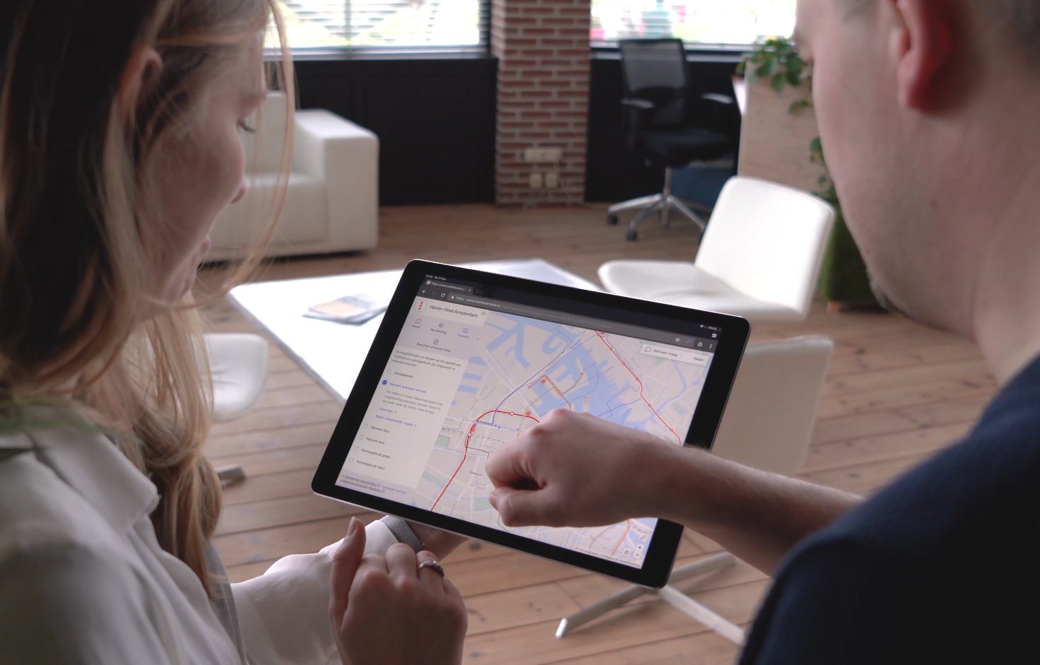
Clear communication and stakeholder involvement are key to successful project development. Our interactive platforms, SEP and VCR, provide innovative ways to present complex projects in an accessible and visually engaging manner. By combining 360° photography, visualizations, and interactive features, we create an immersive experience that informs, engages, and facilitates dialogue. This not only ensures transparency and better decision-making but also helps build understanding and support for your project.
Stakeholder Engagement Platform
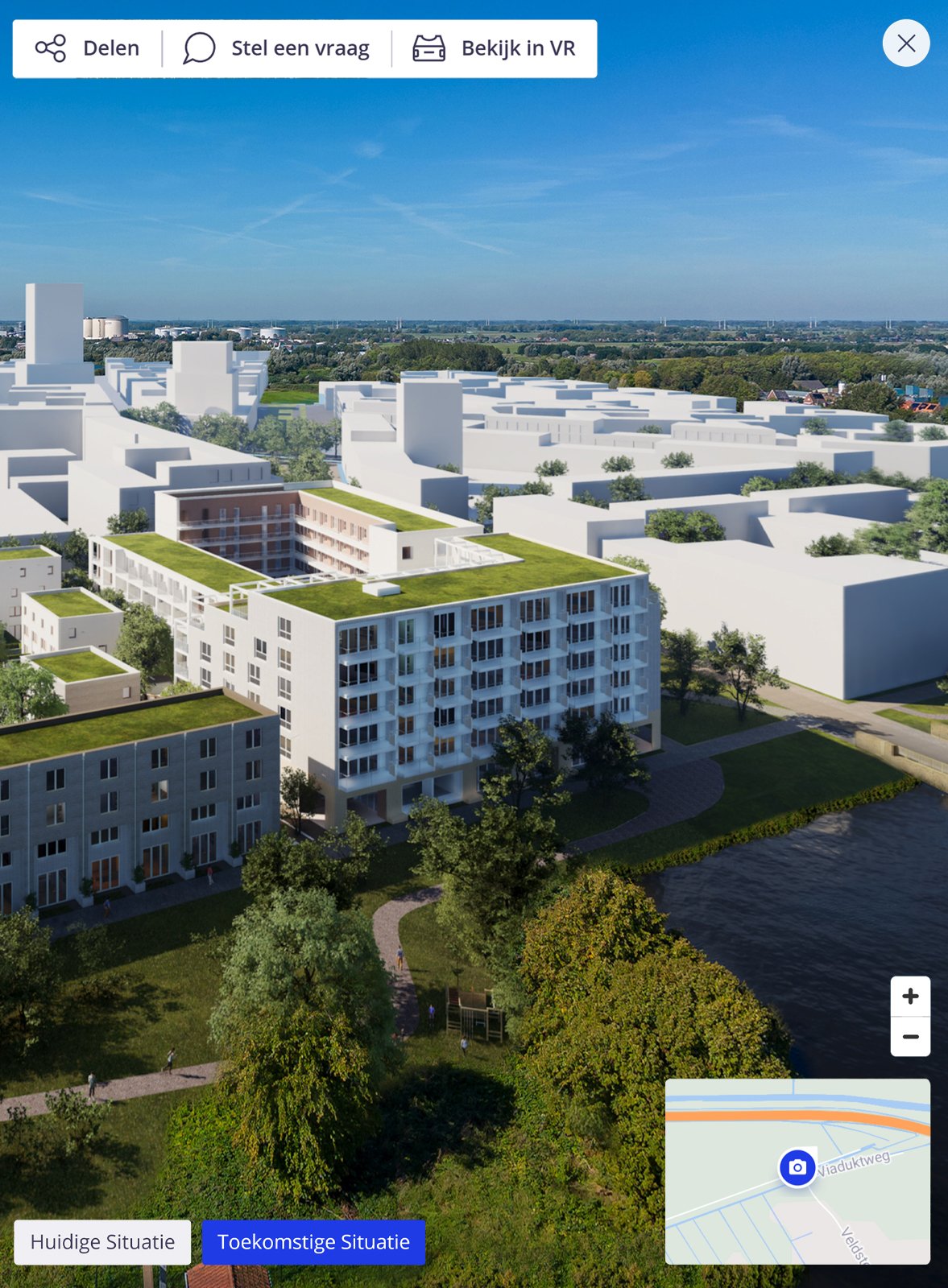
Our interactive platform brings your project to life, allowing stakeholders to explore 360° environments, compare different scenarios, and make informed decisions. SEP seamlessly integrates project data, map layers, and visualizations, providing an intuitive way to navigate viewpoints. It also supports virtual reality and image-guided surveys for an even more immersive experience.
Virtual Consultation Room
The Virtual Consultation Room transforms traditional communication into an interactive digital experience. Using 360° photography and visualizations, visitors gain a highly realistic view of planned changes in their environment. Beyond visuals, key project information, such as studies and reports, is presented in an engaging way. Integrated Q&A modules enable direct interaction with stakeholders, while 24/7 accessibility from any device ensures an open and transparent consultation process.
CAD
Precision and realism with CAD integration.
GIS
GIS for spatial analysis and informed decision-making in infrastructure projects.
Point cloud
Point Cloud technology for precise 3D visualization and modeling.
Photogrammetry
3D models via photogrammetry for accurate existing condition capture.
We support project organizations, architects, engineering firms, and contractors in clearly communicating complex area development plans. Our services help bring infrastructure, urban development, and water projects to life, visually and interactively.
Visualizations
We create realistic 3D visualizations tailored to infrastructure, real estate, and water-related projects. From new road designs and urban redevelopment to flood protection and water infrastructure, our visuals make future scenarios tangible and easy to understand. They are widely used for stakeholder communication, participation processes, and decision-making support.
Animations
Our animated videos convey the story behind spatial plans, illustrating changes over time, phasing of developments, or comparisons between design options. Whether it's visualizing traffic circulation, urban expansion, or the effect of climate adaptation measures, animations make complex content clear and engaging for both professionals and the public.
Support for Information Events
We provide support during information events by helping to present plans in an accessible and interactive way. This includes showcasing our Stakeholder Engagement Platform on large screens and guiding participants through the platform using VR headsets.
This allows stakeholders to explore and understand the proposed plans in an immersive and engaging manner, whether it involves infrastructure, urban development, or water-related projects.
We have had the privilege of collaborating on multiple City projects with the following organizations.

Need a quote? Request one now, and we’ll
reach out to you.
Online quote
Within one working day
Prefer to speak with us directly? Feel free to get in touch with one of our specialists!

