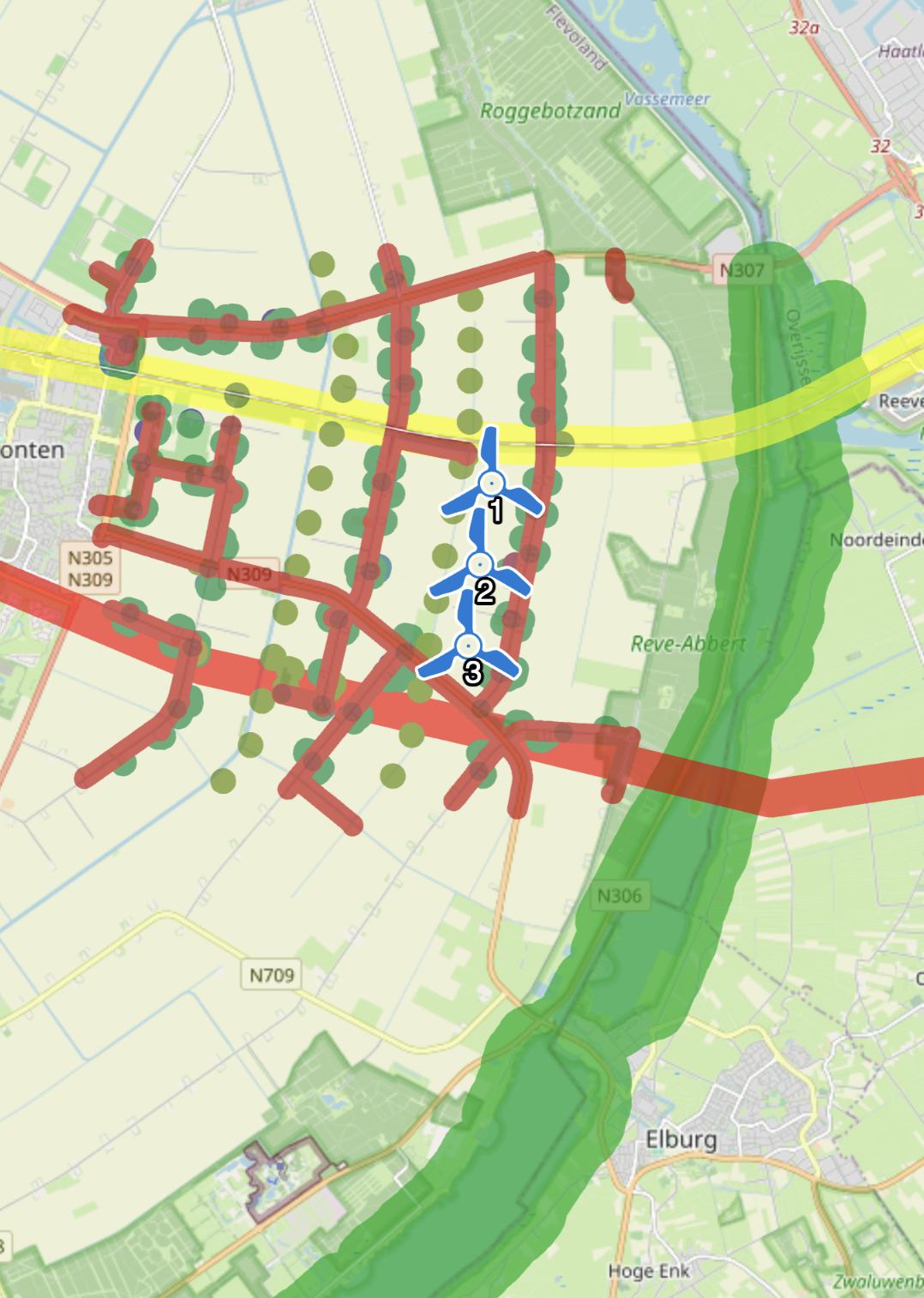
With the Present module, you can independently publish the entire grid infrastructure project including viewpoints, scenarios, and realistic fly-throughs. Easily share the URL or embed the interactive project into your own website.
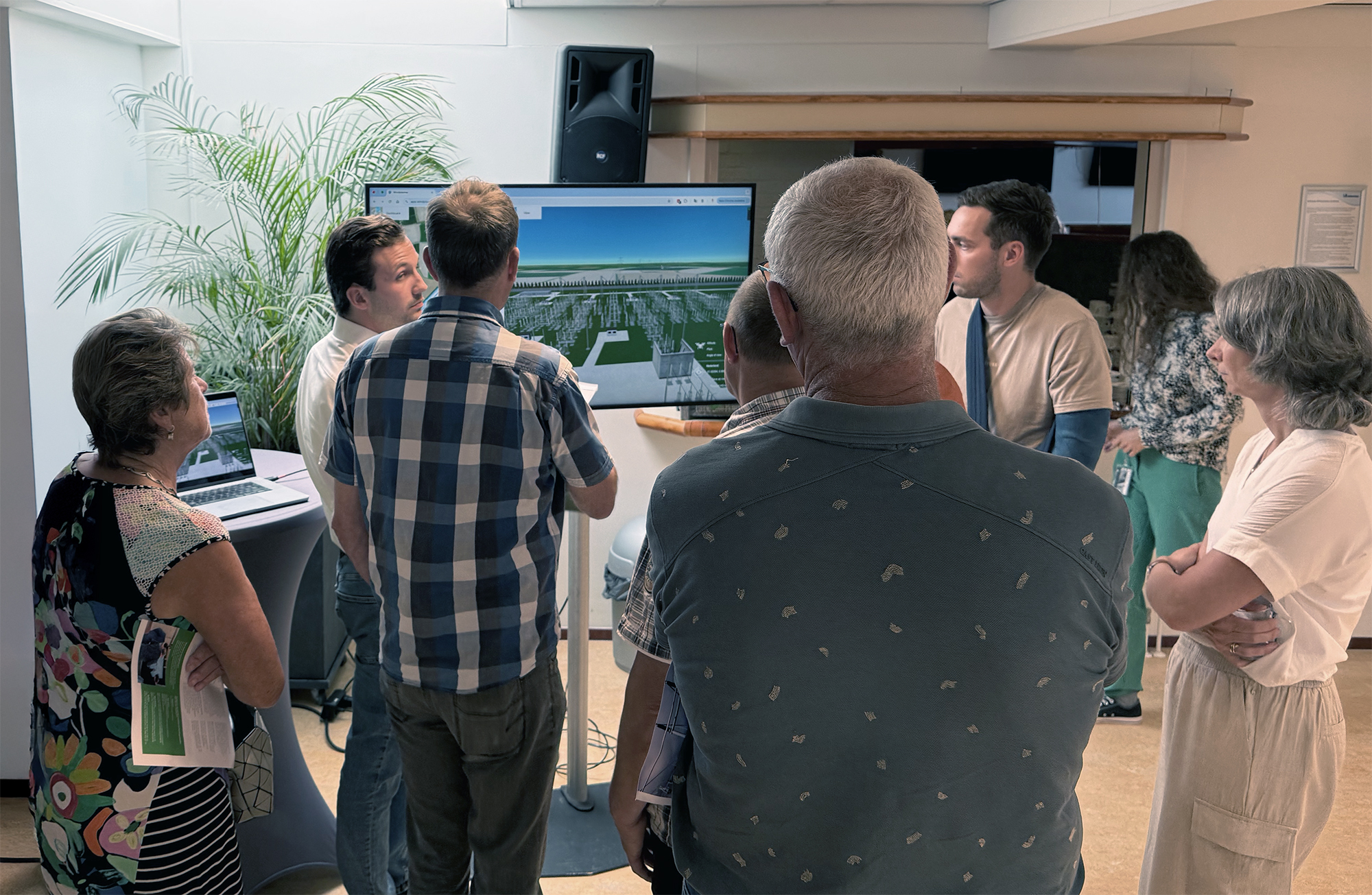
Use the Virtual Consultation Room as an online alternative to a physical open house. Research results and reports are presented in an attractive and accessible way, while the “Ask a question” module enables direct communication with stakeholders.
Publishing and sharing has never been this easy — try it yourself!
.jpg)